Central Anatolia, Turkey
August 1999

After picking up our car, we drove across a bridge spanning the Bosphorus from the European to the Asian side of Turkey, then straight on to Ankara, the capital of Turkey (about five hours). Along the way we passed through Ismit (to become, nine days later, the earthquake epicenter).

1999 Turkey Trip Web Pages

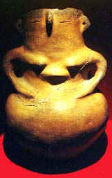
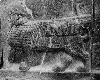
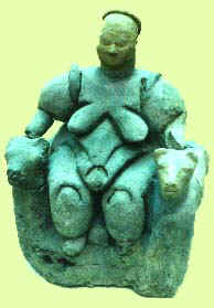
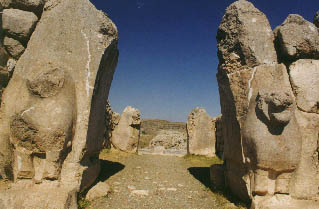
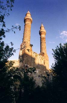
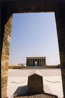
Ankara, though a large modern city (pop. 2.5 million), is very old having been established over 3000 years ago by the Hittites. Two of Ankara's main attractions are the massive mausoleum of Ataturk (right), founder of modern Turkey, and the museum of  ancient Anatolian civilizations.

Ataturk_tomb.JPG (19106 bytes) Ataturk.JPG (8326 bytes)

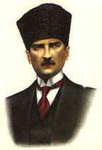
Images of Ataturk are everywhere in Turkey—his photo hangs in every restaurant, every hotel, every gas station, every store, every city has a statue as well as their main street named after him, he is on coin and currency, and he is far and away the most revered figure in modern Turkey—it’s as if we had someone who was Washington, Jefferson, Lincoln, FDR, and Babe Ruth all rolled into one.


The Museum of Anatolian Civilizations, which recently won an award for being the best museum in all of Europe (even though it’s not in Europe), has a fantastic collection of Hittite artifacts as well as ones from neolithic, Greek, Roman, Phrygian, and other civilizations. Generally, one of the problems we were to encounter while visiting ruins would be the lack of anything but larger pieces and foundations because a lot of artifacts had been removed to museums not only in Ankara, but especially in London, and Berlin, as well as other cities.
Hittite_vessel.JPG (12168 bytes) Hittite_relief.JPG (37030 bytes) Hittite stone relief (left) and anthropomorphic vessel (far left) are among the objects in the Ankara museum.
fertility_goddess.JPG (14721 bytes)

pots.JPG (43549 bytes)

Giant pots scattered among the museum grounds (left) and  a fertility goddess (far left) from (if we remember correctly) the 11,000-year-old Çatal Höyük, reputedly the earliest known human community.


Some 200 kilometers east of Ankara is the ancient Hittite capital (2000-1200 BCE) of Hattusas. The site is very extensive, requiring a lot of walking or a car to get from one place to the next. What remains are mostly foundations with the odd partial massive stone sculpture, such as the “Lion Gate” (right). It was at Hattusas that we first experienced the persistence of locals hawking copies of artifacts. lions_gate.JPG (23270 bytes)
12_kings.JPG (47832 bytes) The Hittite religious sanctuary at nearby Yazilikaya, while smaller than than the main Hattusas site, has terrific reliefs of some of the 1000 Hittite deities, many of them copied on small polished black stone and sold for a few dollars by local entrepreneurs here and throughout Turkey. To the left is an image of the “12 kings,” one of the most copied images, on a rock face too large to be carted off to a musuem.
This pyramid structure (below) provided the Hittites with some fortification against enemies. This mysterious green stone (below) is among the ruins of Hattasus shown above with the foundations stone outline of rooms at this 3500-year-old site.
Hittite_pyramid.JPG (38749 bytes) green_stone.JPG (27704 bytes)


Sivas, aside from being in the eclipse path, is the site of Ataturk’s 1919 Congress in his effort to stop foreign domination of Turkey, as well as some impressive Selcuk ruins (the Selcuk’s were a pre-Ottoman Turkish civilization which frequently battled the Byzantines), including the ruins of the 1271 Seminary of the Twin Minarets (right). Sivas_towers.JPG (21402 bytes)


Following the eclipse we drove southwest to Goreme Valley in an area known as Cappadocia. Our first stop (after a night’s rest) was the Goreme Open-Air Museum which featured Byzantine cave churches and dwellings carved out of rock. Afterwards we toured areas with hundreds of fairy chimneys, weird cone-shaped volcanic tufa sticking up from the ground. Finally we visited the underground city near Kaymakli, which descends 10 stories, though we only went down four. The history of this region dates back at least to the Hittites and has been used by various civilizations through to the Byzantines. We stayed two nights in a charming 250-year-old Greek house (recommended to us by some British tourists in Sivas) in the village of Mustafapasa. Ruth (below right) reading our guidebook about this rock-cut chapel decorated with religious Byzantine drawings.
rock-cut_houses.JPG (33887 bytes) Ruth_Goreme_chapel.JPG (36779 bytes)
underground_city.JPG (34360 bytes) undergdcity-Ed.JPG (24797 bytes)

Ruth tries out a cramped room four-stories down in an ancient underground city near Kaymakli in Cappadocia.

Ed poses next to steps leading from one underground level to another.
tufa.JPG (33091 bytes) Ed posing among some of the volcanic tufa of Cappadocia.

rock-cut2.JPG (45803 bytes)

Tufa pock-marked with rock-cut dwellings in Goreme Valley.


han.JPG (37179 bytes) Along the road from high, hot, and dry Central Anatolia to the low, hot, and very humid Mediterranean coast (an eight-hour drive) we stopped at a 13th century han, a  way-station for a Seljuk trade route. Ruth can be seen (if you squint) walking up the steps to the han’s mosque at the center of the compound.

Eclipse War homepage